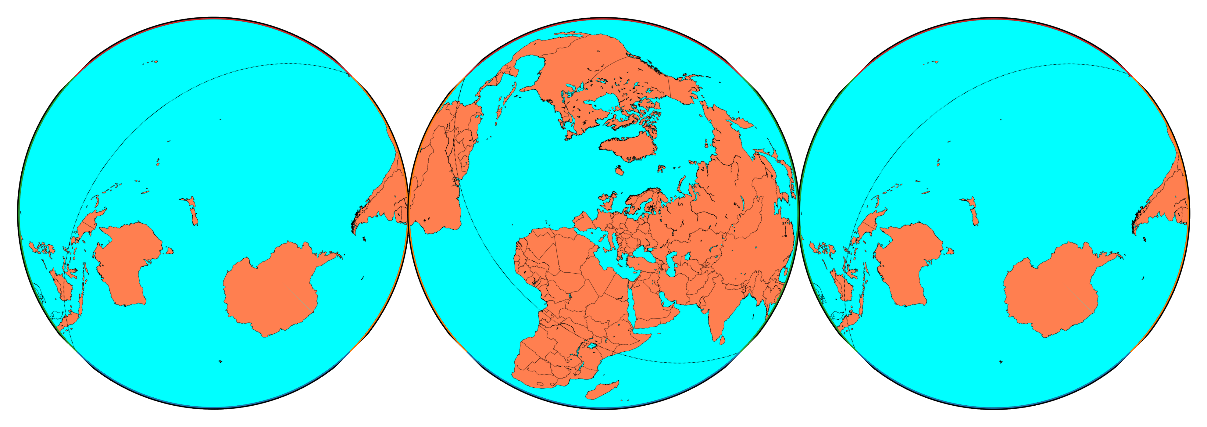
17
- Land and water hemispheres
- Projection: Lambert azimuthal equal-area
- Created with Matplotlib in Python and Paint.NET for post-processing.

For the map enthused!
Rules:
post relevant content: interesting, informative, and/or pretty maps
be nice
That’s the most helpful view of Antarctica I’ve seen. On most projections it looks huge or it’s hard to understand how it’s oriented compared to nearby landmasses.
So close to South America!
So close to South America!
I also made a wider version that is intended to accommodate South America more:
In addition, it just struck me that the OP map might illustrate perfectly the way Chileans perceive the position of their own country in the world.