backpacking

16 readers
1 users here now

  1. Post only about backpacking, hiking, shoestring/long-term travel with a backpack
  2. Recommendations about gear and friendly destinations are welcome
  3. No direct advertising/affiliate links about gears, only your honest opinions and feedback.

founded 4 years ago
MODERATORS
1


While it is true that the Appalachian Trail Conservancy, the nonprofit that helps manage the path and the lands surrounding it, has advised hikers to stay off the southernmost 865 miles, or its lower third, it is not true that those miles are destroyed. Sources I spoke to talked of toppled trees, down branches, and flooding.

2


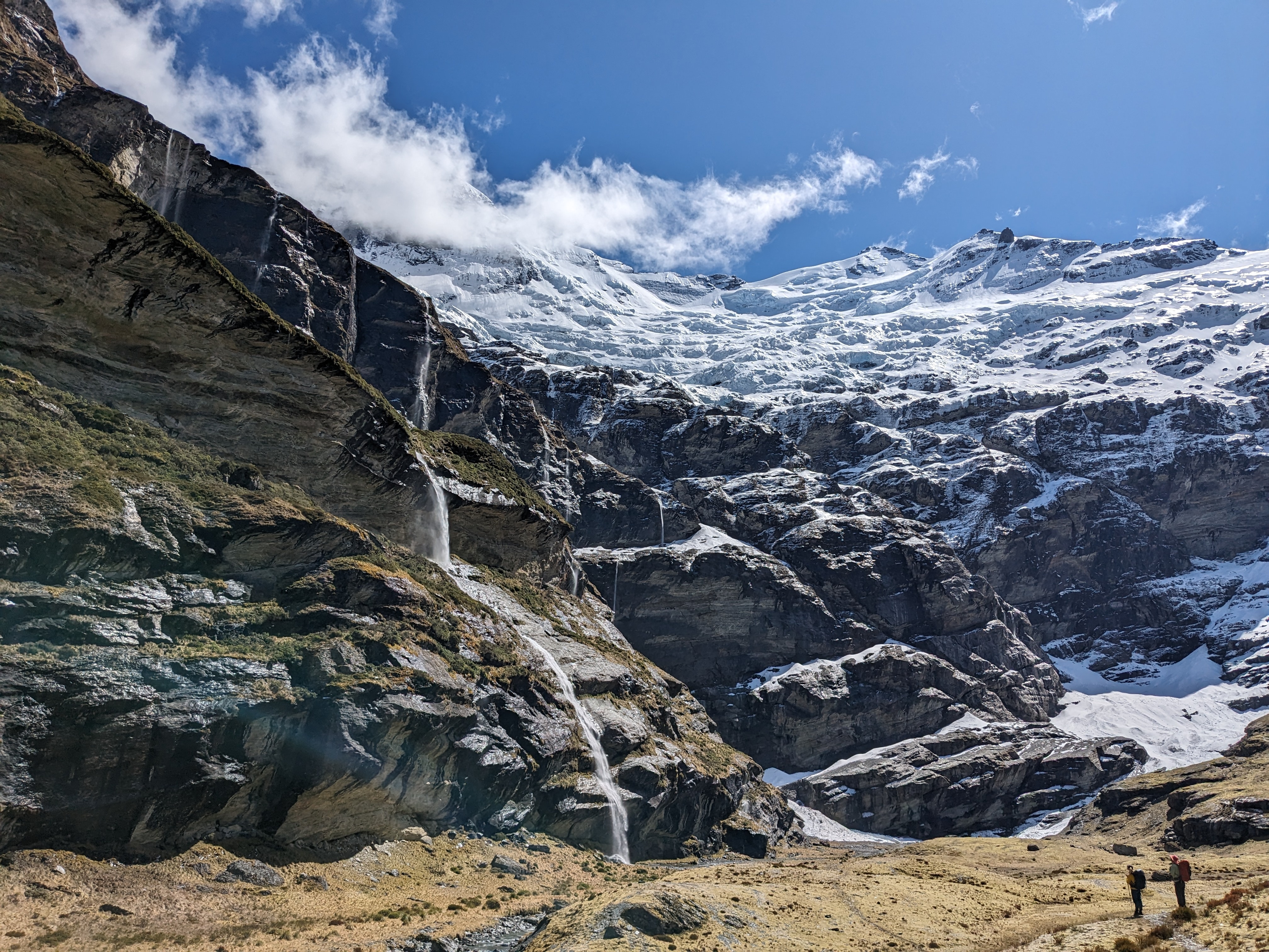
Earnslaw Burn, under Mt Earnslaw (Glenorchy, New Zealand)

3
 
 
4


cross-posted from: https://iusearchlinux.fyi/post/417724

I day-hiked in to the Bighorn Crags area a couple of weeks ago. The Bighorn Crags are named for their bighorn sheep and really cool craggy granite mountains. They are quite old and eroded, with lots of cirques, crags, and towers. I would recommend getting to the trailhead and camping, then backpacking in for a few days.

Getting to the trailhead is a 2.5 hour drive from Salmon, Idaho through forest service roads. The first 1.5 hours are fine - well maintained dirt roads with easy grades. The last 18 miles takes an hour on a really crappy road deep into the mountains. Tire popper rocks abound, so be careful and be prepared! There is a campground at the trailhead.

The trail system is such that you hike along a ridge line for about six miles until you reach the major crags.

From the trailhead you almost immediately hit the Frank Church Wilderness boundary. You will pass some trails to go to a couple of lakes but they are some distance away and a hike down from the ridge line. The ridge line is dry, so bring water.

The first lakes you reach in the crags are Wilson Lake and Harbor Lake at about mile 7.1.

The trail bounces around between about 8500' and 9200' elevation. However, one way is about 1700' of ascent, meaning we had 3400' ascent and 3400' descent in 14 miles round trip.

5


cross-posted from: https://iusearchlinux.fyi/post/277201

I took this out-and-back hike in August 2022. It was a 9.3 mile hike one way. You start in relatively populated national forest land and then as you rise through the mountains, reach the Wilderness area. The trail climbs through Bear Basin, switch backing up the bowl of the basin to the first pass, which is stunning. The descent down the pass is rough with lots of steep gravel. The trail splits and you take the high trail to the east, over the next pass to Summit Lake, which is nestled between two mountains, then over the lass tiny pass and down into the last, big basin. Hike along the meadow until you reach Thompson Lake at the foot of Gallatin peak. You can summit the peak, but I didn't. I surely didn't see a reasonable trail up it!

Elevation

Trail on quad chart

Looking into Bear Basin Looking into Bear Basin

Wildflowers Wildflowers

Looking down into Bear Basin from the pass Looking down into Bear Basin from the pass

Summit Lake Summit Lake

Towards Thompson Lake Towards Thompson Lake

Thompson Lake Thompson Lake

Sunrise at Thompson Lake Sunrise at Thompson Lake

6


cross-posted from: https://iusearchlinux.fyi/post/66105

As promised, here is a trip report!

Trailhead: Palisades campground Path: hike past Lower Palisades lake (4 mi), Upper Palisades lake (7 mi) and into Waterfall Canyon (end at 11 miles).

The snow has melted and the Palisades are in full growth mode! Tons of flowers are blooming or preparing to bloom in the next couple of weeks. Patches of snow still exist in Waterfall Canyon starting at about 7400 ft elevation. There were two waterfalls flowing at the end of the canyon. We camped in some nice established campsites to the west of the trail by one of the lakes at the end of the canyon. It was a quiet day with no other people out past Upper Lake.

(Palisades creek is super fast this year!)

(Upper Palisades Lake is beautiful)

(The main waterfall)

(The other waterfall)

(Lake we camped by)

7


cross-posted from: https://iusearchlinux.fyi/post/354323

Did a quick day hike last weekend to Goldbug Hot Springs in Elk Bend, ID. It's a little under 2 miles one way, and about 900' elevation gain - half of it in the last quarter-mile. You start at a trailhead next to private land and hike about a quarter-mile through private land (it's allowed but stay on trail, dogs on leash and keep your noise level down).

It was very hot in the afternoon and there is little cover, it improves as you approach the hot springs. The springs actually spring cold water and hot water, and some pools are hotter than others, so explore!

The map The map

The approach - the springs are up in the mountains

The vew from the springs back down

The hot springs

8


I went here with my 6 year old daughter and my parents this past weekend. I grew up coming here with my dad and it feels really special to share it with my daughter. I can't wait to go back.

9


Looking for a new backpack. I don't like having 40 pockets to stash stuff in. I would prefer a frame but not having one isn't a deal breaker. Have lower back issues so it needs to sit appropriately.

MOLLE, ALICE, ILBE, or FILBE? Something else?

10


One of my favorite campsites. I did the North Lake to South Lake loop (about about fifty miles) back in 2020.

Sadly, most thru-hikers on the Pacific Crest Trail or the John Muir Trail will hustle past here, as they’re always trying to get from Muir Pass to Muir Trail Ranch (or vice versa, if they’re southbound) in a day. But, it’s a beautiful place, worth stopping to see at different times of day.

Deer grazed in the meadow, as well as in my campsite as I made my morning coffee. If you’re an angler, Evolution Creek is full of golden trout, and make for a fantastic diet addition along the trail.

It is one of the most peaceful places in the Sierra Nevada, if you visit at the right time of year. This was back in late 2020, and I was able to be all alone here, due to the pandemic keeping the backpackers’ numbers down.

11


I enjoy hiking and backpacking. I go to Yellowstone once a year.

What's the best pack to buy? I have one but bought it at Sports Academy and I feel there should be better ones out there.

12


For all your wonderful hikes out in the wilderness, come join !wilderness_backpacking@iusearchlinux.fyi ! Remember to follow Leave No Trace principles on your travels :)

13


I am looking at creating my backpacking kit. I just wanted to know what people consider their top items in their backpacking kit that might not be considered "essential" (tent, clothes, cookware, etc) or what they'd recommend looking into to improve the (already great) backpacking/camping experience.

Note : alcohol is supposed to be 'non-essential' !

14


I've had an absolute overkill vault for years and intend to switch to a sack (obvs unless the area has aggressive bears and/or the park specifies vaults are required).

What would you add as a luxury item to take up the newly available weight and volume? Currently leaning towards a lightweight backpacking chair. Getting up off the ground and having a backrest after a long days backpacking sounds great.

I have a 36L bag, so the vault takes up A LOT of the volume. And I shoot for midweight, say <20lbs dry weight.

Option 2, but vetoed by my frequent adventure buddy, was harmonicas for some nighttime jams. I can't play harmonica, so backwoods camp seemed like a good place to practice.

15


i don't want to make advertising, but i found an affordable product for backpacker : a 12 inch tablet with a weight of 520g.
When a 10 inch tablet is 400g, and a 13.3 inch laptop is nearly 1kg, a 12 inch/520g is a good screen size weight/ratio. What do you think ? (Note : no direct advertising for a product, only features and why it could be a good product for backpacker)

16
17
1
submitted 1 year ago* (last edited 1 year ago) by myself33@lemmy.ml to c/backpacking@lemmy.ml


You don't know where to backpack in peru?
Vinicunca, also called Montaña de Siete Colores (literally: Mountain of seven colors), is a mountain in the Andes of Peru with an altitude of 5,200 metres (17,100 ft) above sea level

Do you want to see more content like this? let me know.

18


First significant post since coming over from Rexxit. Photos from a recent two-night trip through the Dominguez-Escalante National Conservation Area in Western Colorado. We nailed the timing; biting bugs weren't too bad and while it was starting to get warm, the heat wasn't overwhelming yet.

19


a good community should always have a mascot : our mascot will be this little girl with her backpack, just because a backpacker is not always a big man with beard !

So here is the challenge : post a picture of your backpacking trip with the mascot

20


there are other camping/hiking/thru-hiking communities and i would like to know what kind of content you want to see : long-term travel with a backpack? hiking only? what's for you the difference between backpacking and hiking?

21


in 2022, a french hiker who hike the PCT decided to create the first 3000 km trail in europe. you can follow an introduction in this youtube video. Enjoy : https://youtu.be/wzy8DzsSu5k Note : i'm not the girl on the video, don't send me personal message !

22
 
 
23


Hi, anybody in Lemmy backpacking these days? Could be a great community here, hope it gets content, I’ll try to add something.

24


Backpacking the Tecumseh Trail in southern Indiana

25


Durmitor, montenegro
you can hike through durmitor national park and camp near the lake. Montenegro is a country so diverse and stunning.

view more: next ›